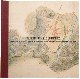
Territorial statistics and land cartography in Spain (1845-1985): a local approach
The management of the taxation on property, crops and livestock, implemented as a result of the fiscal reform of 1845, gave rise to the production of vast quantities of fiscal documentation including taxable-wealth estimates (amillaramientos), tax evaluation records (cartillas de evaluación), land-parcel maps and statistical registers of rural property. These two latter types of document have not received excessive attention. They nevertheless constitute a manuscript source of great value for the study of agrarian structures, the reconstruction of the rural landscape, and for knowledge of the history of cadastral cartography in Spain in the second half of the 19th century. The purpose of this research was to study documentation of this type existing in the province of Barcelona, from a critical, documentary viewpoint.
Aims
1 – The creation of a complete cartobibliography of municipal land- parcel documentation from the province of Barcelona carried out between 1845 and 1895.
2 – A cartographic analysis of this documentation (scale of drawings; type of documentation: land-parcel plans, land-parcel atlases, plans of municipal perimeters; state of conservation of the cartographic documents).
3 – A study of the institutions involved in the compilation of this cadastral cartography (Statistical Commission of the province of Barcelona, local councils and expert committees), and of the cartographers responsible for it.
Results
After exhaustive consultation of archives, libraries and map libraries, at both national and regional, as well as at local level (National Geographical Institute, Madrid; Army Geographical Centre, Madrid; the San Fernando Royal Academy of Fine Arts, Madrid; Archive of the Crown of Aragon, Barcelona; Historic Archive of the City of Barcelona, Barcelona; Library of Catalonia, Barcelona; Victor Balaguer Library-Museum, Vilanova i la Geltriu; Cartographic Institute of Catalonia, Barcelona; Library of the Higher Technical School of Architecture of Barcelona, Polytechnic University of Catalonia, Barcelona: Library of the Royal Academy of Science and Arts of Barcelona, Barcelona; Library of the Sant Jordi Royal Catalan Academy of Fine Arts, Barcelona) we have managed to catalogue a total of 140 land-parcel documents corresponding to 103 municipalities of the province of Barcelona, drawn up between 1849 and 1883. Within this documental whole, we have managed to catalogue 19 municipal land-parcel atlases.
A payroll or register has been made of the land surveyors involved in the drawing of the municipal land-parcel maps in the Barcelona province. The compiled register consists of 45 biographical outlines, each corresponding to one of the land surveyors we have managed to identify as authors of one or other of the said municipal land-parcel maps.
We have also gathered a variety of historical documentation (land-measurement books, municipal territorial statistics, land-surveyors contracts, records of complaints for damages) which constitutes a very valuable source for the study of the landscape in the Barcelona province in the mid-19th century, and for the analysis of all this cartographical documentation.
