Meritxell Gisbert Traveria, member of the GEHC, tells his thesis, entitled Cartografia i transformació del territori a Catalunya entre l’Antic Règim i la Revolució liberal (ss. XVIII-XIX): el paper de la família Soler, in this talk from the past 28 January 2021, which was organised by the Societat Catalana de Geografia. The thesis was read on June […]
News
The french Archives Nationales organize, at their headquarters in Paris, the exhibition Quand les artistes dessinaient les cartes: vues et figures de possible espace français, Moyen Âge et Renaissance. The exhibition focuses on a collection of local and regional maps produced in France between 1300 and 1600 with a marked practical nature: defining boundaries or […]
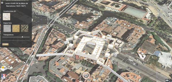
The next December 12, Thursday, it will take place in the Geologic and Cartographic Institut of Catalonia (ICGC), between 09:30 and 12:30, the Journey of presentation about the georeference and 3D modeling of the map of Barcelona plain made by the French army between 1823 and 1827. The Lever-nivelé (1823-1827) encompasses the fortified area of Barcelona and highlights by […]
The next 20 June, at 10:00, our colleague Meritxell Gisbert i Traveria will defend her thesis Cartrografia i transformació del territori a Catalunya entre l’Antic règim i la Revolució liberal (ss. XVIII-XIX): el paper de la família Soler. This thesis has been developed thanks to an awarded grant to work with the GEHC in the frame of the project La cartografia urbana […]


