The series of the 1:50,000 scale Topographical Map of Spain
The 1:50,000 scale Topographical Map has been the base map of official Spanish cartography for more than a century, and the essential tool for knowledge of the geographical reality of Spain. However, academic knowledge of the history of the National Topographical Map was superficial and very fragmentary. In particular, the various series and editions of the map had not been catalogued and studied as a whole. The aim of this research project was to study the different series of the Topographical Map from a critical and documentary viewpoint.
Aims
1 – Creation of a complete cartobibliography of the 1:50,000 scale Topographical Map of Spain.
2 – Analysis of the cartographical characteristics of each series and edition of the map (system of drawing up, engraving and printing procedure, the geographical information shown, etc.) and its variations throughout the publication process.
3 – Study of the technical institutions and bodies – both national and foreign – which have taken part in the production and publishing process of the Topographical Map.
Results
Prolonged research work in diverse archives and map libraries in Spain (National Geographical Institute, Madrid; Army Geographical Centre, Madrid; General Military Archive, Ávila and Segovia; Cartographical Institute of Catalonia, Barcelona; Academy of Sciences, Barcelona; Military Museum of Montjuich, Barcelona) and abroad (Istituto Geografico Militare, Florence; Library of Congress, Washington, and The Map Library, London) enabled the location and catalogation of eleven different series of the 1: 50 000 scale Topographical Map of Spain, with a total collection of over 8,000 sheets printed between 1875 and 1995. Six of the series studied and inventoried are the product of Spanish cartographical institutions. The remaining five owe their existence to foreign military bodies: the Army Map Service of the United States of America, the German Army General Staff (Generalstab des Heeres), the Military Geographical Institute of Italy (Instituto Geografico Militare), and the War Office of Great Britain.
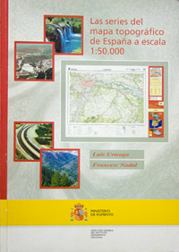
Once catalogation work had been completed, an overall analysis of the various series and editions was carried out. The result appears in diverse publications, among which the book Las series del mapa topográfico de España a escala 1:50.000, published by the National Geographical Institute in 2001, deserves a special mention (Madrid, Dirección General del Instituto Geográfico Nacional, 397 pages). Below, the scientific publications resulting from the project are listed.
