Female Monastery of Sant Daniel de Girona
The gathering and subsequent dumping of the information contained in the manuscripts of the monastery of Sant Daniel de Girona into a GIS map allows us to place all its assets and easily visualize how their heritage evolved over the two hundred years studied. In this sense, we see how the majority of acquisitions made during this period followed the expansion lines marked by the extensive endowment made by Countess Ermessenda and Count Berenguer Ramon I in 1018, being especially important the assets that this female monastery accumulated in the plain of Girona, in the areas of Montfullà and Salt. However, Sant Daniel also seized land in other places where it previously had no assets, especially in the north of the Serra de las Gavarres, where it ended up hoarding important assets and controlling some domains in the neighbouring county of Empúries. Among many other things, this should make us consider, the importance of the valley of Sant Daniel, where the monastery is located, as a place of passage and connection between the central area of the county of Girona and the Empordà area.

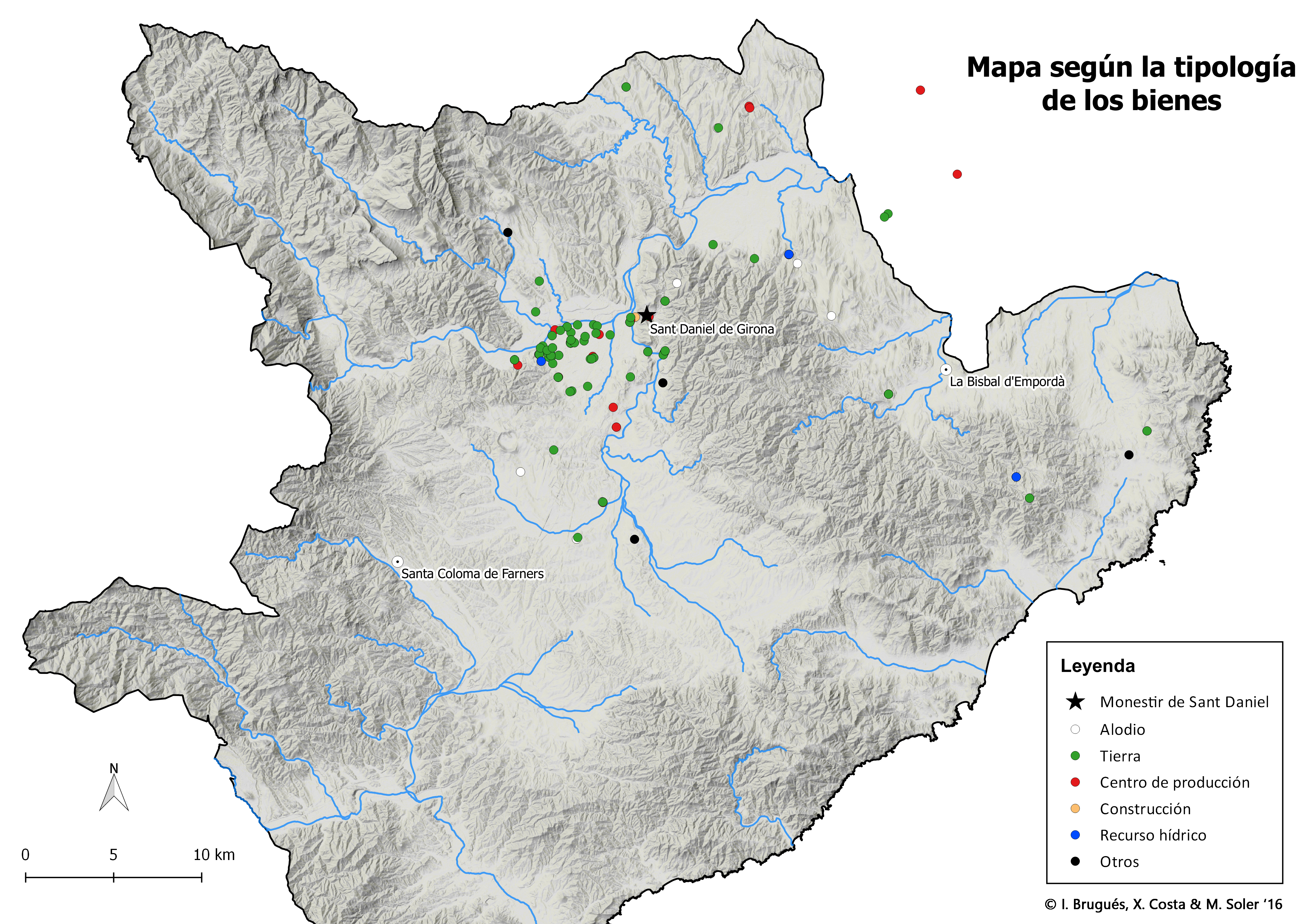
In addition to generating these series of maps that show the monastery's possessions at different chronological points, working with GIS also allows us to observe how the different types of possessions were distributed throughout the territory. In this sense, it is interesting to see that the lands acquired by the monastery were basically concentrated in the plain of Gerona, a very fertile area and relatively close to the monastery. On the other hand, the most distant goods were generally not individualized lands, but mansos; that is, agricultural production units with a high degree of autonomy that would function almost independently, limiting their relationship with the monastery to the payment of established annuities.

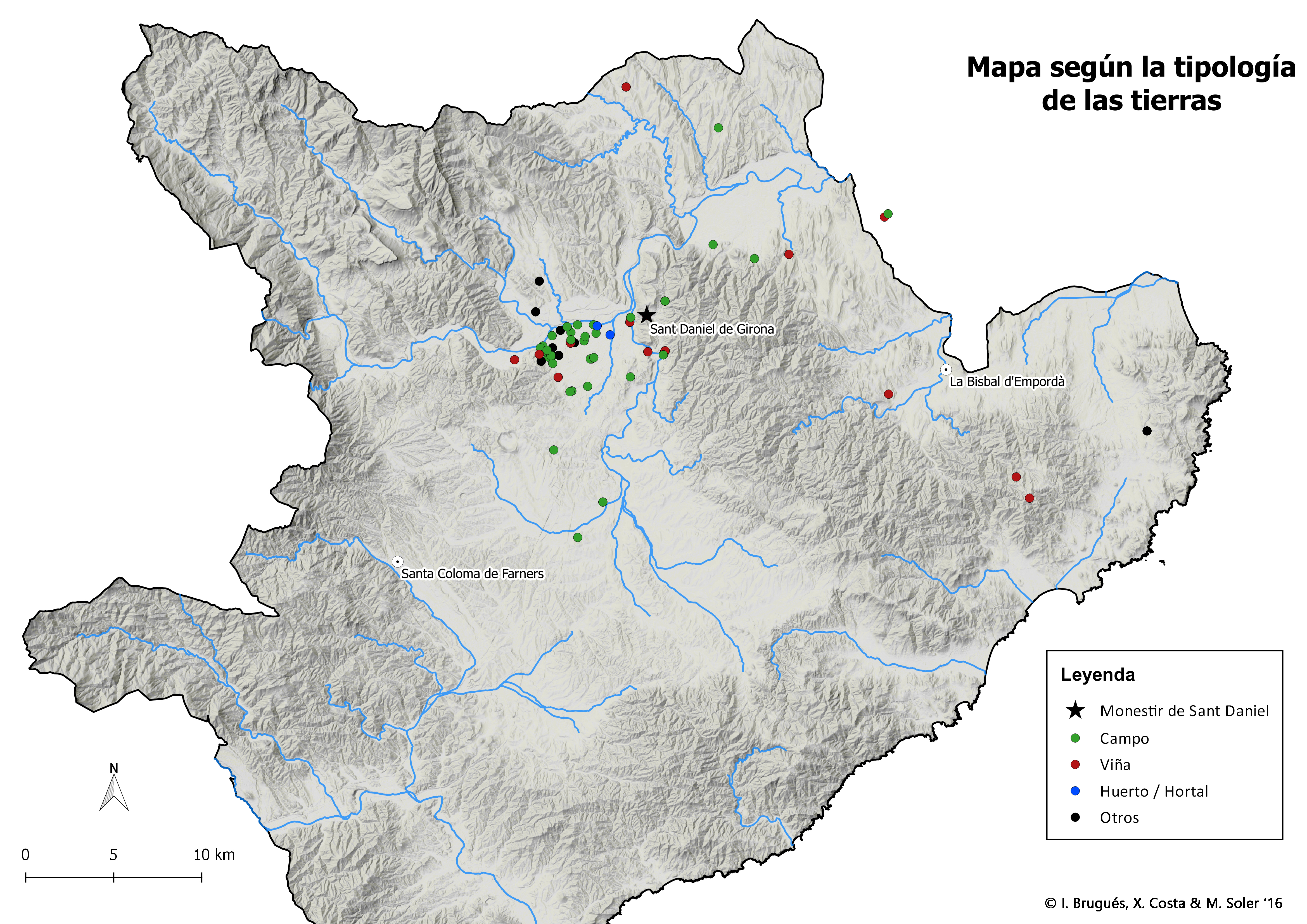
Similarly, if we focus on the typology of the land owned by the monastery, we see that cereal fields were concentrated on the plain, while orchards and other irrigated crops were located near water streams. But it is more interesting to note how the vineyards were situated in the wildest areas of the territory and, for example, concentrated on the contours of the plain of Girona, taking advantage of the slopes where extensive cereal cultivation would have been more difficult.

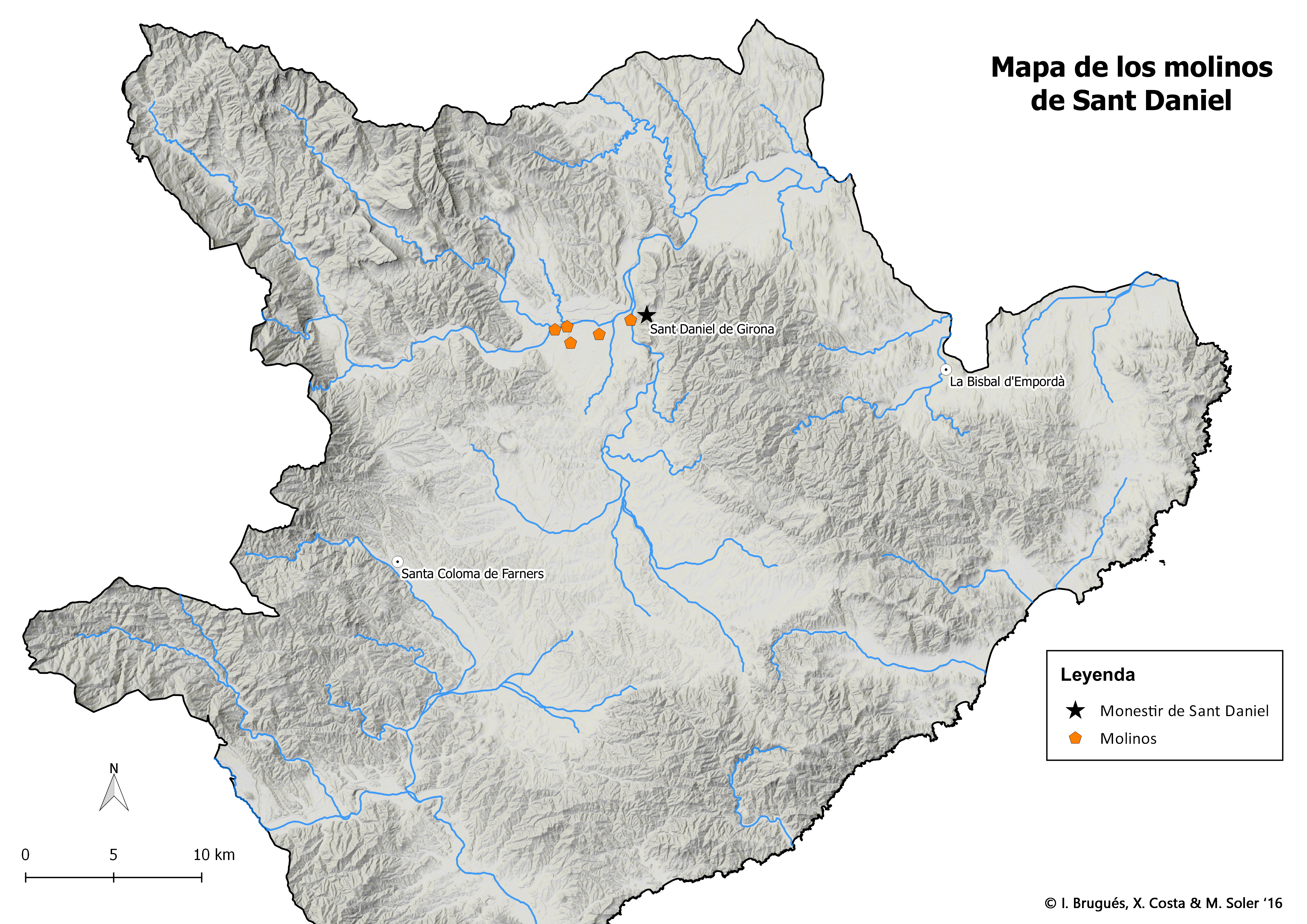
Finally, it should also be noted that GIS maps allow us to study the presence and distribution of a particular type of goods. Thus, for example, we can create a map with all the mills owned by the monastery. In the case of Sant Daniel, these mills were concentrated on the banks of the River Ter, in the area of Montfullà and Salt. This information helps us to better understand how the medieval landscape was organized.
