GPS technology to analyse seabird movements and expand Spain’s network of marine protected areas
The AMPLIAMAR project, an initiative by the University of Barcelona, aims to develop a proposal to extend the network of marine protected areas throughout Spain’s marine demarcations. This biodiversity and marine ecosystem protection initiative will be based on GPS telemetry tracking of different seabird populations, and it will contribute to the delimitation of Key Biodiversity Areas (KBAs), areas that are critical for the protection of species and natural ecosystems.
AMPLIAMAR is led by Professor Jacob González-Solís, from the Faculty of Biology and the UB’s Biodiversity Research Institute (IRBio). It is coordinated by researcher Diego Vicente and includes the participation of predoctoral researchers Guillem Izquierdo and Beñat García, postdoctoral researcher Sara Albuixech and Professor Raül Ramos (UB-IRBio), as well as technicians Adrián Pina and Celine Van Weelden.
The project is supported by the Biodiversity Foundation of the Spanish Ministry for Ecological Transition and the Demographic Challenge, through the Pleamar Programme, co-funded by the European Maritime, Fisheries and Aquaculture Fund (EMFAF). The fishermen’s guilds of Ciutadella (Menorca), San Pedro del Pinatar (Murcia), the Andalusian Federation of Fishermen’s Guilds (FACOPE) and the Provincial Federation of Fishermen’s Guilds of Alicante (Valencian Community) are also collaborating.
GPS technology to track smaller seabirds
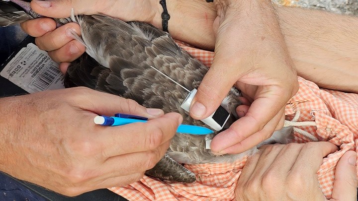
GPS telemetry is a technique that has revolutionized the study of the ecology of movement in the natural environment. AMPLIAMAR, which will be deployed from 2024 to 2026, will collect all known data on seabird movement tracking using GPS technology and will integrate available spatial information on human activities — particularly fishing — in all Spanish marine demarcations. Professor Jacob González-Solís, head of the UB’s Seabird Ecology Lab, notes that “remote monitoring of seabird movements using GPS devices with high spatial and temporal resolution tells us very precisely where the main feeding and resting areas of most seabird species are”. “Thanks to the contribution of dozens of research teams and Spanish and international NGOs, we can know the movements of birds whether they are breeding, passing through or wintering, thus contributing to the identification of key areas for biodiversity”, adds the expert, distinguished by the ICREA Academia 2023 programme.
| AMPLIAMAR will enable expanded remote monitoring studies of more sensitive and poorly known seabird species and populations. |
Current telemetry technology allows remote monitoring of the smallest seabird species. “With the application of GPS technology connected to mobile phone systems such as GSM, we will be able to monitor species that are difficult to recapture, such as the Manx shearwater (Puffinus puffinus) in the Canary Islands, a species that is declining in the archipelago”, says Diego Vicente, coordinator of the project and member of the UB’s Department of Evolutionary Biology, Ecology and Environmental Sciences.
By applying new standardised analysis tools, it will be possible to analyse the GPS trajectories of the studied seabirds to facilitate the delimitation of the KBAs. As part of the project, the team will also analyse the overlap between human activities and the Spanish Network of Marine Protected Areas (RAMPE) in order to define a new extension of the network and thus improve the conservation and biodiversity of marine ecosystems.
